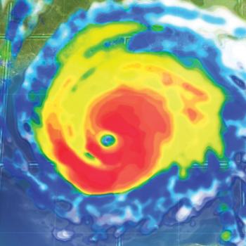
Tropical Storm Bill threatens areas already overwhelmed by flooding
DALLAS (AP) — The eastern half of Texas was preparing for renewed flooding as Tropical Storm Bill approached the state's Gulf Coast.
The National Hurricane Center predicted the storm would make landfall Tuesday morning somewhere between Baffin Bay, south of Corpus Christi, and High Island, just up the coast from Galveston.
Galveston County officials already have directed voluntary evacuation of the low-lying Bolivar Peninsula, where Hurricane Ike wiped out most structures in 2008. School districts from Galveston to the Houston suburbs have canceled Tuesday's classes.
According to projections by the National Weather Service, parts of North Texas, Arkansas and Oklahoma could get up to 9 inches of rain over the next five days, and Missouri could get more than 7. After last month's historic rains and floods, the forecast was expected to complicate ongoing flood-containment efforts.
"If we get that much rain in that time, there's probably going to be a resurgence of flooding along these rivers," said Kurt Van Speybroeck, meteorologist for the weather service in Fort Worth.
Memorial Day weekend storms brought widespread flooding to Oklahoma and Texas, killing more than 30 people. At one point last month, 11 inches of rain fell in some parts of the Houston area, resulting in flooding that damaged thousands of homes and other structures and forced motorists to abandon at least 2,500 vehicles across Houston.
More than 10 inches of rain fell over a 30-day period across nearly the entire central and eastern portions of Texas — from the Panhandle south to the Mexico border. Isolated areas received 15 to more than 20 inches.
Those wet conditions could help strengthen the storm, according to Marshall Shepherd, director of atmospheric sciences at the University of Georgia.
While tropical storms usually gather power from the warm waters of the ocean and then weaken once they move over land, NASA-funded research has shown some storms can actually strengthen over land by drawing from the evaporation of abundant soil moisture, Shepherd said. The phenomenon is known as the "brown ocean" effect.
"All the things a hurricane likes over the ocean is what we have over land right now," said Shepherd, one of the principals who conducted the research.
On Monday, portions of the Red River were near or above flood stage as it runs between Oklahoma and Texas and then extends into Louisiana. Meanwhile, the Trinity River was above flood stage in many areas of East Texas.
Lake levels across Oklahoma remain high from May rainfall, which has forecasters watching rivers in Arkansas ahead of the tropical system.
"We have had time to recover but not a whole lot," said NWS hydrologist Tabitha Clarke in North Little Rock, Arkansas. "(The tropical system) is going over areas that are already sensitive. ... It's kind of a perfect storm. There are a lot of things lining up."
Shepherd said it won't be immediately known if the brown ocean effect holds true for this storm but an indicator will be whether it forms an eye while well inland. He cautioned that often it's not the larger category storms that produce the most rainfall, but instead smaller tropical storms.
On Monday night, the city of Houston activated its Emergency Operation Center, and Dallas was preparing to take similar actions Tuesday evening.
Francisco Sanchez, spokesman for the Harris County homeland security and emergency management office, said crews were continuing to work to remove debris from bayous so that water could flow more freely and not build up when the heavy rains begins.
- Log in to post comments
